
Locate Ludlow Neighbors Around a Parcel
The useful block record is a set of sources with different limits. Start with an anchor parcel, retain the date and map setting, then compare each nearby parcel with its own recorded evidence. A current owner field is not the same as an occupant list. A directory street entry is a dated historical observation. The voter form is an individual verification tool, not a block roll. Those distinctions keep the search tied to records that actually exist.
| Block source | What it can show around an address | Access and limit |
|---|---|---|
| Ludlow GIS selected parcel | Anchor parcel, situs, map position, and owner or address result | Current public viewer; save the retrieval date |
| GIS adjacent or abutter mode | Parcels sharing or near the selected lot, depending on the setting | Distance, Adjacent, Add or Remove Parcel, labels, and report output |
| Registry plan or deed | Legal boundaries, lot or plan references, and conveyance parties | Modern online index and images; older books, microfilm, or counter route |
| Directory street section | Historical household or address entries for a publication year | Intermittent Ludlow and regional collections, not a current roster |
| Voter-status form | An individual’s submitted registration-status match | Name, full birth date, ZIP, and agreement required; no block export |
| Precinct street index | Election precinct and polling-place geography | Town election information, not a voter-name list |
Use the record date beside every result. An abutter map and a historical street listing may concern the same address, yet describe entirely different moments.
Choose a Ludlow Anchor Parcel
The Ludlow Online GIS Property Viewer is the proper place to establish an anchor. Enter a known street number and name in the free-text field, select the matching suggestion, and record the returned ID, situs address, owner field, and any unit or complex value. The public interface does not document a distinct global owner-name form. If the only fact is a name, contact the Assessor or request a defined existing record rather than assume the map will search every owner.
Keep the situs address separate from any mailing address that appears in assessment or tax material. A situs is the physical parcel location. A mailing address is where a notice goes, and it may be a post-office box, another town, a business office, or an out-of-state location. Neither one identifies every person associated with the property.
The public GIS interface shows Ludlow’s parcel-search result and map controls.
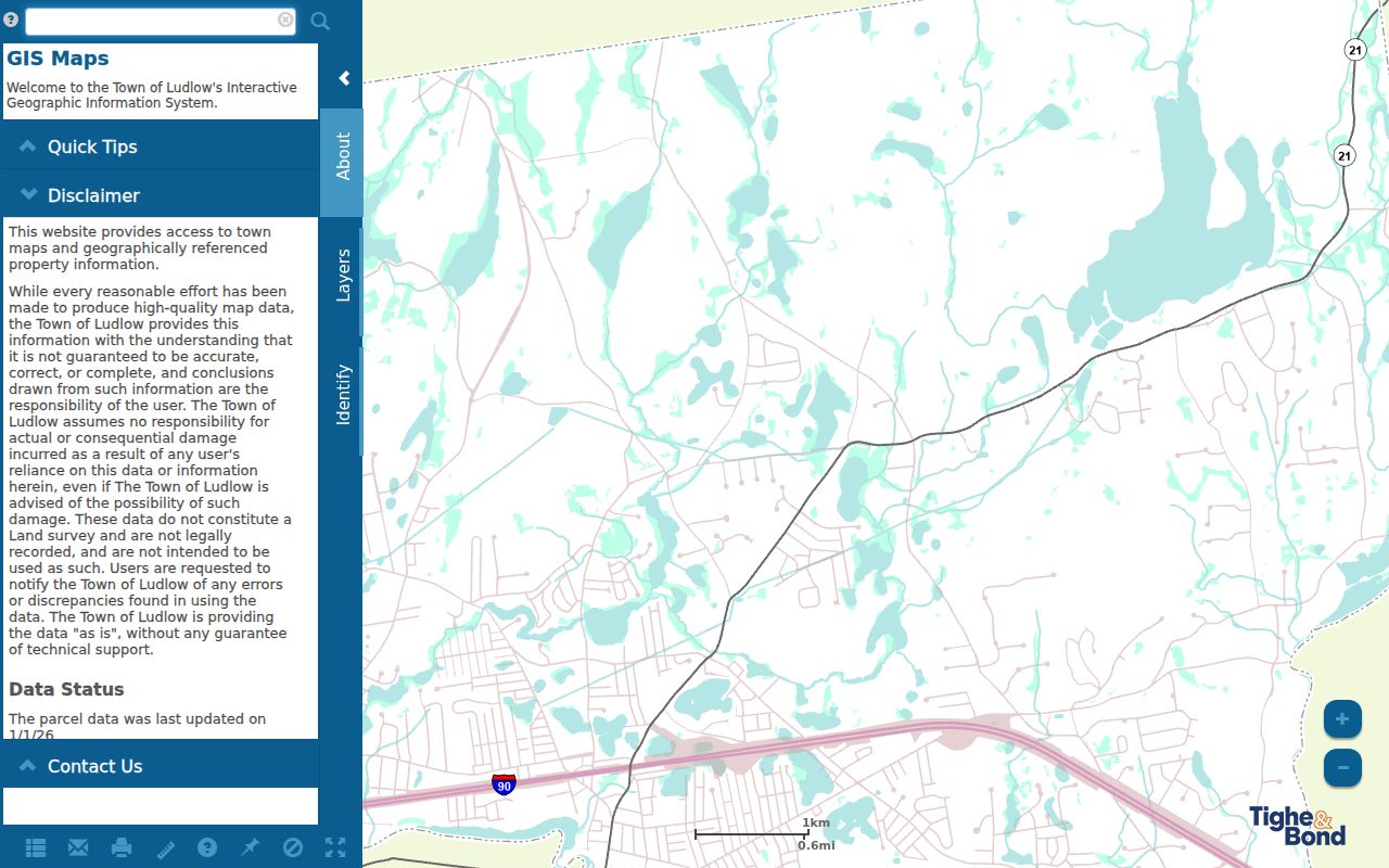
After a parcel is selected, preserve its ID and source date before using an adjacency setting or comparing it with a Registry instrument.
Note: Map result fields can change, so retain the parcel ID and retrieval date with each result.
Map Ludlow Parcel Records
Ludlow’s GIS can create a reproducible nearby-parcel set. From the selected address, open the map or detail view, enter an abutter distance if needed, choose Adjacent or use Find Abutters, and inspect the returned parcels. The map also offers Add Parcel, Remove Parcel, Print Labels, and Export Report. Record the configuration before moving from a map result to a deed or directory.
Address → selected parcel → parcel ID and date → Adjacent or distance setting → returned parcel IDs → owner or deed fields → dated directory or precinct context.
Repeat the same capture for each returned parcel: ID, situs, owner or address fields, legal plan or deed reference, latest recorded conveyance, and any relevant public permit result. Use a reported distance or adjoining edge as a geographic research boundary only. It does not designate a social neighborhood or establish that two households know each other.
For a full named-street title chain rather than a compact block view, the Ludlow street directory follows the address through GIS, Registry, and historical street records.
Ludlow Household and Parcel Records
An adjacent parcel can point to a property owner, not automatically to a resident or household. The current assessor card may show an assessment owner, but a deed, probate filing, corporation record, or tax mailing address can explain why that person is not at the situs. A unit or complex result needs its own selection. A property can also have more than one historical household while a deed names only an owner.
Use the Registry to confirm a conveyance party and legal description, not to infer who was present on the block on a given day. Then use a historical directory street section only as a date-stamped household clue. When the sources conflict, preserve the difference rather than forcing one person into every field.
Note: A Registry party and an assessment owner can represent different roles in the same property trail.
Save a Ludlow Abutter Record
Use Print Labels or Export Report only after recording the anchor parcel and the selected setting. That makes the nearby-parcel result repeatable later, even when assessment data changes. If more than one parcel is needed as a reference point, add it deliberately and remove it before a new search. The viewer’s measure controls can show feet, square feet, length, or area, but a measurement tool supplies map geometry, not personal information.
The official Assessor’s abutters request is a separate option for a defined parcel. Its form asks for property location, map, parcel, property owner or owners, requester contact information, and the stated board or licensing purpose. That is different from looking at the map. It is also more exact than asking the town to assemble a general list of people nearby.
Note: An exported abutter set is a map relationship, not a statement about residents, friends, family, or community membership.
Read Ludlow Block Records in Time
For historical context, locate the nearest available directory year by surname and then read the street section or house guide when the volume provides one. Include nearby numbers rather than stopping at one name. A block read can show initials, a boarder, a second household, an old street spelling, or a move to another Ludlow address. It may also show no entry at all, which should remain a gap rather than a negative claim.
The Massachusetts State Library lists Ludlow runs for 1897–1898, 1901, 1904, 1908, 1924, 1926, 1933, 1935, 1938, 1941, 1966, and 1968. Springfield’s regional directories can help with nearby context, but Ludlow inclusion must be checked in the specific volume. Pair a directory year with a deed, plan, town report, obituary, or census date before describing a block over time.
The State Library holdings list is the strongest published check for those exact Ludlow directory years.
Note: A directory entry is a dated publication clue, not a current household confirmation.
Place Ludlow Neighbors in a Precinct
Ludlow’s election information supplies a civic layer for an address. The town has six precincts: Harris Brook Elementary serves Precinct 1; Paul R. Baird Middle School serves Precincts 2 and 6; Ludlow High School serves Precinct 3; East Street School serves Precinct 4; and First Church Center serves Precinct 5. A street index and precinct materials can help identify the right polling-place geography.
The Ludlow election information also directs residents to registration and election resources. Registration is not automatically updated when someone moves within town. The public voter-status form is designed for an individual’s own match using name, birth date, ZIP, and agreement. It does not expose a complete precinct or block list, and a no-match does not prove a person never lived in Ludlow.
Find Ludlow Community Context
Public community sources can add organization context without exposing individual membership. The town’s hazard-mitigation planning inventory names Piney Lane Neighborhood Association and also identifies faith, civic, youth, and fraternal organizations. The inventory requires a current-status check. It is not a neighborhood-boundary map or an official directory of members.
Piney Lane Neighborhood Association
Named in the town’s planning inventory. Current activity, boundary, and contact route require verification before relying on them.
Ludlow Park Residents Association
Its public presence shows newsletter and member-login routes, but no public member directory was inspected.
Ludlow Community Association
Useful for general civic context. No public individual-membership list was located in the reviewed materials.
The official planning inventory is the source for the named community context. Contact or join through an organization’s current public route, rather than treating a private member area as public information.
Note: No current umbrella directory, public member list, or association-boundary map was located in reviewed sources.
Compare Ludlow Block Record Types
Official parcel and land records can be checked against the custodian and carry a map, deed, or dated directory context. Commercial people-data categories can combine old and new material from uncertain sources. Neither category supplies a complete household picture, and neither should be used to bypass a protected record or turn a nearby address into a personal profile.
| Source type | Useful for | Important limit |
|---|---|---|
| Official GIS and Assessor records | Current parcel location, map, and assessment owner field | Owner of record is not a complete list of occupants. |
| Registry deeds and plans | Conveyance parties, legal description, and title trail | Land ownership does not identify current household members. |
| Historical directories | Dated address or household context | Coverage is intermittent and entries are not current evidence. |
| Commercial people-data category | A possible lead to verify with a custodian | Accuracy, date, coverage, and privacy controls require independent checking. |
When an official record is missing, ask the proper custodian about an existing address-keyed record and any redactions. Do not fill the gap from an unverified profile.
Respect Ludlow Block Lookup Limits
What remains private around a block is as important as what a map can show. Household members not named in a public record, utility and delivery customers, protected voters, Address Confidentiality Program participants, sealed court material, restricted vital records, and inferred social relationships should not be treated as public block data. A parcel result is a geographic record. It is not a dossier on the people around it.
The Massachusetts Address Confidentiality Program provides a substitute-address and mail-forwarding route for qualifying people. Protected or redacted fields create a legitimate no-data result. Ask the responsible custodian about its correction, redaction, or appeal procedure instead of attempting to infer the missing information.