
Ludlow ZIP Code Coverage
Only one Ludlow ZIP and post-office pairing was verified in the reviewed official sources. Use that limited result as a mail-routing fact, not as a claim that the town boundary and a postal boundary are identical. USPS delivery geography is built for mail. Municipal parcels, recorded land, and Census places follow different systems. The ZIP code directory therefore starts with the confirmed pairing and keeps uncertain edge-address questions open for an address-level check.
| ZIP | Verified coverage | Post office | Use and limit |
|---|---|---|---|
| 01056 | Ludlow mailing area verified by the USPS post-office listing | Ludlow Post Office, 83 Winsor Street, Ludlow, MA 01056-9998 | Confirm a complete edge address through USPS; not a legal town boundary |
USPS lists the Ludlow Post Office at 83 Winsor Street with the 01056-9998 address and its public retail schedule. No official source reviewed supplied a second Ludlow ZIP, an exception list, a boundary polygon, a ZIP split history, or a street-by-street mailing map. Adding another ZIP from a neighboring community would overstate the record.
Ludlow ZIP Code Directory Facts
A ZIP code is a delivery designation, not a jurisdiction. Ludlow is a town in Hampden County, and the municipal geography described by the Census is not the same thing as an area served by a post office. A parcel can be inside town government records while its mailing address routes differently, and a ZIP can extend across a municipal line. The right result depends on the question: use USPS for deliverability, Ludlow GIS for a municipal parcel, and the Hampden Registry for a recorded legal description.
The difference matters most when an address sits near an edge or when an old document uses a historic street string. Preserve the exact address as written, the postal ZIP, the parcel identifier, and the deed book or page when available. Those fields can point to the same place while serving different record systems. A ZIP code directory is most reliable when it leaves that distinction visible.
Postal limit. ZIP 01056 is confirmed as the Ludlow post-office pairing, but it is not an official survey of Ludlow’s municipal limits or a list of every deliverable address.
Verify Ludlow ZIP Code Delivery
Use the USPS ZIP Lookup Tool only with a complete deliverable address. The tool can validate an address-to-ZIP or ZIP+4 pairing. It does not show ownership, household membership, municipal jurisdiction, or everyone associated with that route. For an old or disputed address, compare USPS output with the town’s property map and the wording in the deed rather than replacing one type of address with another.
- Enter the complete street address, city, and state in the USPS address lookup.
- Save the returned ZIP or ZIP+4 as a delivery result, including the date checked.
- Search the same street number and name in the Ludlow GIS to identify the municipal parcel and situs address.
- When a property history matters, compare the parcel with the Hampden Registry deed and its legal description.
Keep the postal and parcel results side by side. An address may change administratively while a recorded instrument still refers to a lot, plan, metes-and-bounds description, or a prior street number.
Ludlow ZIP Code Search Fields
The Massachusetts voter-status screen is a real ZIP-capable form, but it is not a ZIP-wide people search. It requires the exact combination of first name, last name, complete birth date, five-digit residential ZIP, and an agreement checkbox. That combination can check the submitted individual’s registration information. It cannot produce a public directory of residents in 01056, and the result should not be scraped or republished.
| First and last name | Required text fields for the submitted individual |
|---|---|
| Birth month, day, and year | Required dropdown fields |
| ZIP code | Required five-digit ZIP of the residential address used for registration |
| Agreement checkbox | Required acknowledgment before search submission |
| Search result | Individual match or no-match status, not a complete town roll |
The official voter-status form displays the fields that make this limit clear.
A broader voter record is a separate request to the proper custodian. Ask the Ludlow Town Clerk or state office which existing record is releasable, which fields are withheld, the current fee, delivery format, and permitted use.
Find a Ludlow Resident by ZIP
A ZIP can narrow a search only after a person or address is already known. There is no official public Ludlow-specific portal identified in the research that exports all residents filtered by ZIP. Use the number to complete an individual status form, validate a mailing address, or distinguish similar street addresses. For a historical person, connect a dated directory or vital index to the person’s name and address rather than assuming the current postal designation existed at the time.
- Start with a complete name plus a date of birth, known address, or historical year.
- Use USPS to confirm the mailing ZIP for a complete current address.
- If checking personal voter status, use the required name, complete birth date, ZIP, and agreement on the state form.
- For property context, use GIS and a deed record, keeping the assessed owner, mailing address, and occupant as separate ideas.
- For a full address trail after the ZIP is confirmed, use the Ludlow street directory record workflow.
Note: A ZIP narrows a submitted search or validates delivery, but it does not establish who currently lives at an address.
Ludlow ZIP Code Parcel Geography
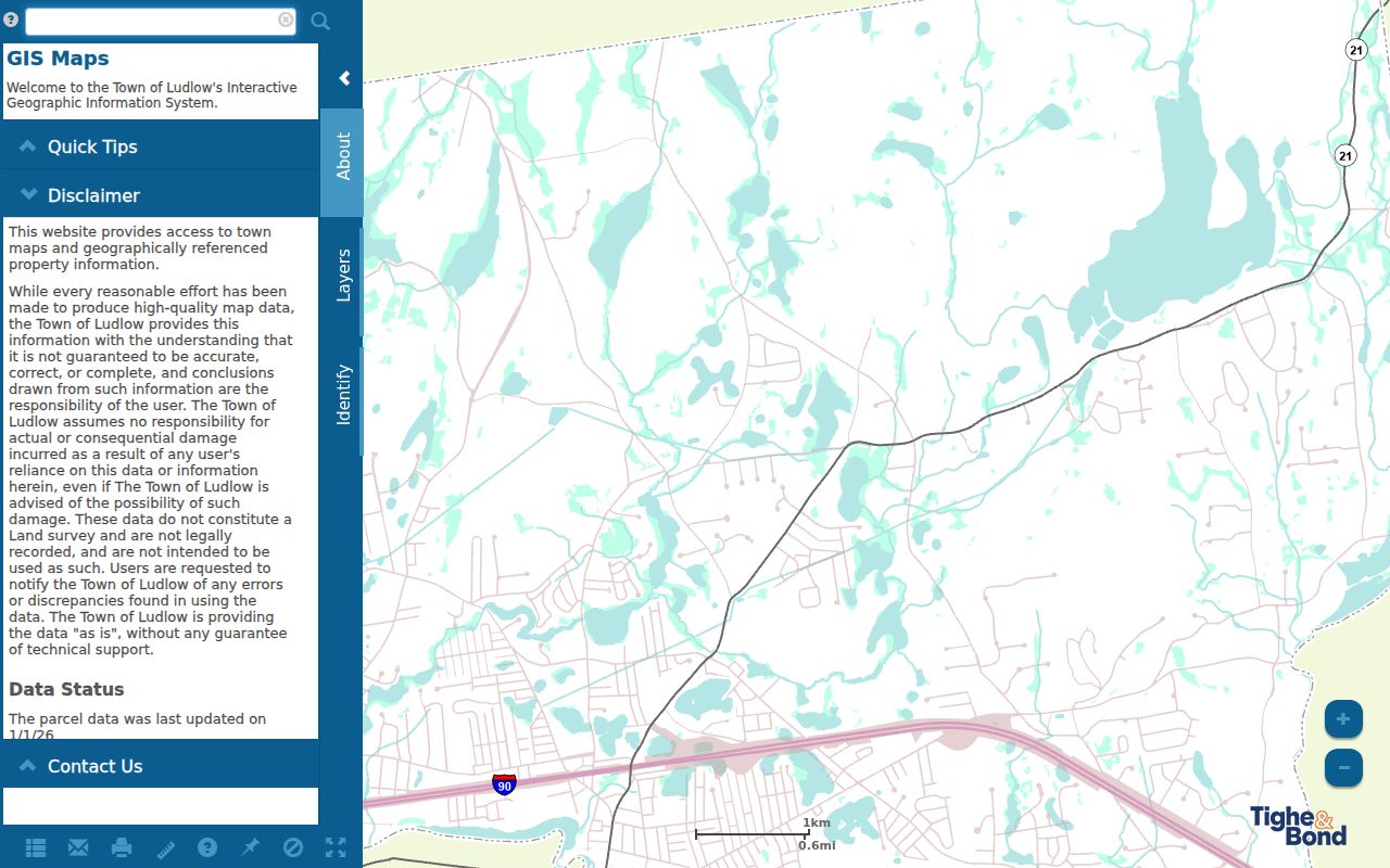
The town’s Web GIS property viewer is the practical municipal route for a situs address and parcel map. Its map-first search uses free text and autocomplete suggestions. A selected result can show ID, index or parcel value, complex, unit, owner, and address before Parcel Details. The interface does not provide a separately documented owner-name, parcel-number, or ZIP advanced-search form. Search a known address and ask the assessor about other existing records rather than assuming those filters are available.
The Ludlow GIS viewer displays address suggestions, parcel results, and map controls that separate municipal geography from postal delivery.
Its owner field is an assessor field, not proof that the named person receives mail at or occupies the property. Record the situs address, parcel identifier, and owner label exactly as shown, then use deed information if a recorded title question remains.
Ludlow ZIP Code Boundary Limits
No official source reviewed provided a complete Ludlow ZIP boundary polygon or a street-by-street exception list. That absence is important. Do not infer the ZIP line from the town line, a GIS parcel outline, or a nearby post-office label. Edge addresses, PO boxes, and institutional delivery points can route differently. USPS, the town, Census, and the Registry may also present the same place using different naming conventions.
For a property question, let the map and parcel record identify the town context. For mail, let the complete USPS lookup control. For a recorded land question, rely on the legal description, plan, lot, or book and page. Preserving all three forms prevents an old address or a mail route from being mistaken for proof of parcel continuity.
Definitions for Ludlow ZIP Codes
These labels help keep postal routing terms from being used as property or resident claims.
- ZIP code
- A postal routing code used by USPS for delivery. It is not a municipal boundary or a list of people.
- ZIP+4
- An added four-digit delivery detail returned for a complete address. It improves routing precision but does not establish ownership.
- PO-box ZIP
- A ZIP designation used for post-office boxes. It can differ from the ZIP used for a physical delivery address.
- Unique ZIP
- A ZIP assigned to a single organization or large mail recipient. No verified Ludlow example was located in the reviewed sources.
- Carrier route
- A USPS delivery sequence within a ZIP area. It is a mail-routing concept, not a public resident directory.
Ludlow ZIP Code Records Trail
Postal, municipal, and land records can be used in sequence without treating them as interchangeable. Address to USPS delivery result, then address to Ludlow GIS parcel, then parcel or owner name to the Registry deed index is a useful trail. The Registry may show a town, name, document, date, property, or legal-description clue, but postal ZIP is not the legal key. For older material, the Registry’s computer index begins in 1966 while records reach much further back through books, microfilm, and other historical routes.
When a historic address appears in a directory, preserve the street spelling and publication year. A regional directory may use a publisher’s geographic category rather than a present USPS label. The 1919 Ludlow Sanborn map has five sheets and can provide building-footprint context, but it does not prove who received mail or lived at an address.
Ludlow ZIP Code Directory Gaps
The verified table is intentionally short. No complete public Ludlow resident list by ZIP, USPS ZIP+4 range list, official ZIP realignment history, or town-specific exception map was found in the reviewed sources. A public map does not fill those gaps, and a ZIP filter on a license or voter form narrows a submitted query instead of creating an address directory.
The lack of a ZIP-wide export is a privacy and data-quality limit, not a missing shortcut. A property card can show a current assessor owner, a voter form can return information for required individual inputs, and a historical directory can place a name at an address in a published year. None supplies a complete, current roster for a mailing area.
If an agency record is needed, request the specific existing record from its custodian under the Massachusetts Public Records Law, G.L. c.66 §10, while recognizing that exemptions and redactions can apply. State the address, date range, desired format, and the field needed. Ask for the fee estimate, retention period, and appeal route rather than asking an office to create a new ZIP-based resident list.